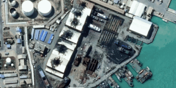
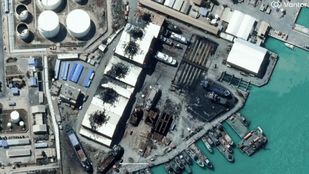
- Satellite images have provided a rare view of Iran, capturing significant damage across the country.
- The damage is a result of the U.S.-Israeli military strikes, which have affected numerous locations.
- Images display burning facilities and widespread destruction from Tehran all the way to the Gulf region.
- These before-and-after images highlight the extent and severity of the strikes on Iran’s infrastructure.
- This visual evidence offers a unique insight into the impact of recent military actions on Iranian soil.
- The strikes mark another chapter in the ongoing tension between Iran, the U.S., and Israel.
- The satellite imagery serves as a critical tool for understanding the immediate aftermath of such conflicts.
Source: https://www.foxnews.com/politics/new-satellite-images-reveal-fires-damage-iranian-naval-bases-after-us-israeli-strikes)


